Look at Myrtle Beach areas after Tropical Storm Debby. More rain expected
READ MORE
Tropical Storm Debby
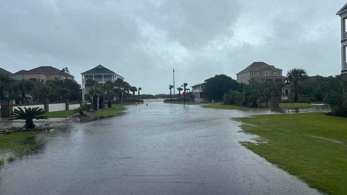
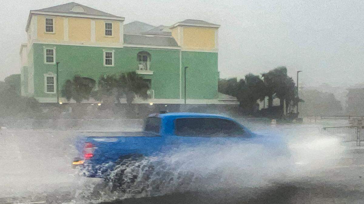
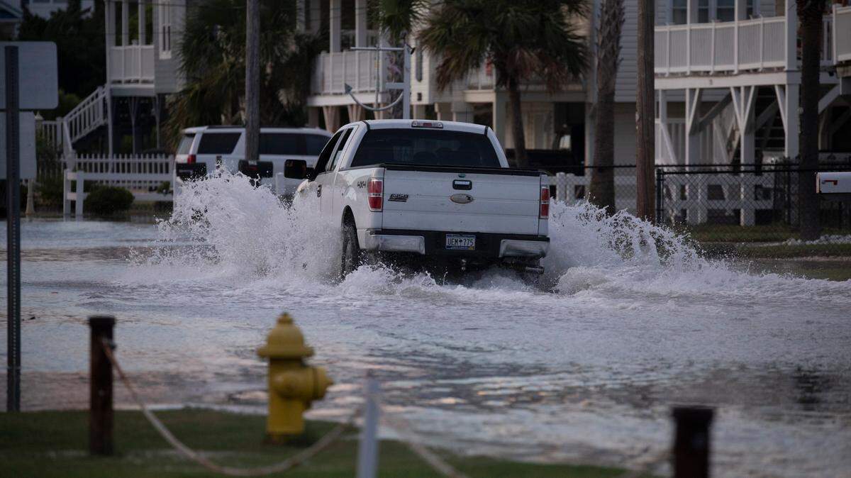
Historic rainfall from Tropical Storm Debby could lead to dangerous flooding. The rain will likely bring dangerous flooding, including flash floods, urban floods and potential storm surges.
Expand All
Tropical Storm Debby is expected to continue affecting the Myrtle Beach area all day Thursday into the early hours of Friday morning, with most of the system clearing by the weekend.
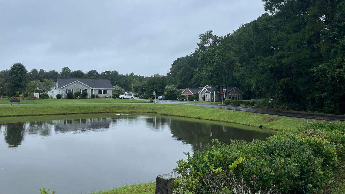
Meteorologists say that some inland areas of Horry County are still vulnerable to flood events.
Flash floods are still possible, and officials are warning people against driving in flooded areas and bypassing barricades on the road, as this can be deadly.
According to a late-night update from the National Weather Service in Wilmington, NC, major flooding is now predicted for the Pee Dee River at Galivants Ferry.
This is the first named tropical system to work its way through Myrtle Beach during the 2024 hurricane season.
Here are the latest updates:
Flood, tropical storm warning for Horry County canceled
UPDATE 2:11 P.M.
The National Weather Service canceled the flash flood warning for the northern part of the county, saying that flooding is no longer expected to pose a threat.
However, drivers should still continue to heed remaining road closures.
In addition, the tropical storm warning for Horry County, which includes Surfside Beach, North Myrtle Beach and Myrtle Beach, has been canceled.
A flood watch remains in effect until 8 a.m. Friday for portions of southeast North Carolina and northeast South Carolina.
- Terri Richardson, trichardson@thesunnews.com
Horry County Schools back to schedule
UPDATE 1:22 P.M.
Horry County Schools will return to normal operations on Friday, Aug. 9, including athletics and extracurricular activities, according to an email from spokeswoman Lisa Bourcier.
The schools were moved to remote operation earlier this week ahead of Tropical Storm Debby’s landfall in the region.
- Elizabeth Brewer, ebrewer@thesunnews.com
Emergency center closes
UPDATE 12:57 P.M.
Horry County closed its Emergency Operations Center at 1 p.m. on Thursday.
The county said in a mass email that government offices and facilities are scheduled to reopen Friday during their normal times.
The county will also move its operations down a level to OPCON 2, which means “enhanced awareness,” as it continues to monitor river levels.
- Elizabeth Brewer, ebrewer@thesunnews.com
Horry County still under tropical storm warning
UPDATE 12:23 P.M.
Horry County remains under a tropical storm warning until further notice, according to the National Weather Service in Wilmington, North Carolina.
The warning for Georgetown County was canceled.
High wind gusts are expected in Pawleys Island in Georgetown County and in the Myrtle Beach area, including North Myrtle Beach and Myrtle Beach. Gusts can reach up to 44 mph, according to NWS.
- Terri Richardson, trichardson@thesunnews.com
More rain forecast for this weekend
UPDATE 12:11 P.M.
More rain from a different weather front could lead to additional flooding, according to National Weather Service meteorologist Steven Pfaff.
“While Debby’s rainfall will exit the area later today and tonight an approaching front from the west could result in additional showers and a few thunderstorms during Friday, and into Saturday,” he said via email. “These additional showers and thunderstorms could lead to localized flooding.”
Pfaff said the storm surge in the area has subsided, and the Tropical Storm Warning remains in effect for Horry County.
- Elizabeth Brewer, ebrewer@thesunnews.com
Rainfall amounts released. How much did you get?
UPDATE 11:35 A.M.
The Loris area received more than 15 inches of rainfall from Aug. 5, 2024, through Aug. 8, 2024, according to the National Weather Service in Wilmington, North Carolina. The most received in Horry County from Tropical Storm Debby.
North Myrtle Beach received 14.25 inches of rain during the same time period and Myrtle Beach received 7.2 inches.
Other rainfall totals include 10.35 inches in the Socastee area, 4.5 inches in the Surfside Beach area and 11 inches in the Little River area.
- Terri Richardson, trichardson@thesunnews.com
Flash floods still pose a risk
UPDATE 11:06 A.M.
A flash flood warning was put into effect in northeastern Horry County until 2 p.m., according to the National Weather Service.
At 11:04 a.m., emergency management reported flash flooding across the warned area. Between 6 and 11 inches of rain have fallen in the area and flash flooding is already occurring in parts of Horry County, according to NWS.
- Terri Richardson, trichardson@thesunnews.com
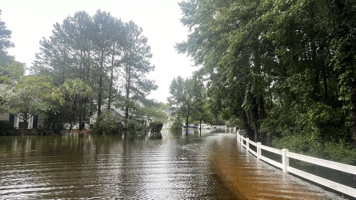
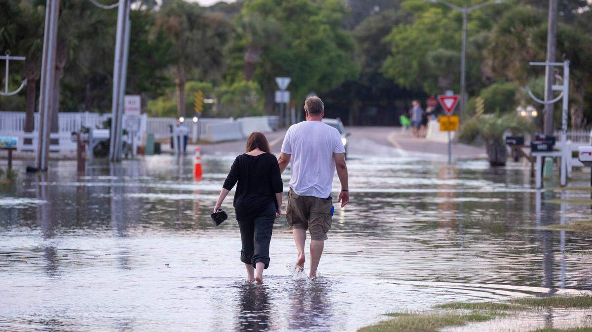
Flood warning issued
UPDATE 10:46 A.M.
A flood warning was issued for inland parts of Horry County until at least Thursday evening, according to an alert from the National Weather Service.
The Waccamaw River in Conway is facing the biggest flood risk, with NWS forecasters warning that the Witch Golf Links and homes on Riverside Drive north of town may begin to flood, with the neighboring swamps remaining heavily flooded.
The river is expected to rise to 11.9 feet Thursday night, which is above its 11 foot flood height. With more rain, that crest number could end up being much higher.
- Elizabeth Brewer, ebrewer@thesunnews.com
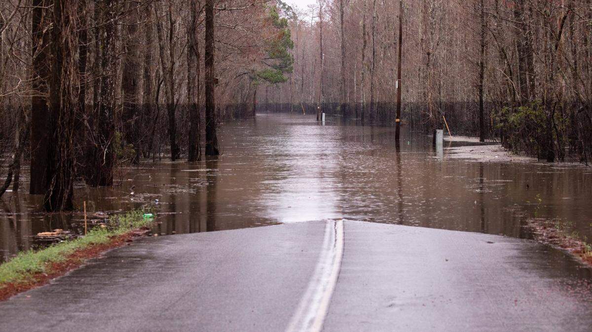
Loris flooded after Debby
UPDATE 10:12 A.M.
Photos and videos show inland flooding in the Loris region.
Previous reports from forecasters show that the area received close to 10 inches within the past few days.
The National Weather Service out of Wilmington, North Carolina, said continued flooding in the area is expected for the next day.
- Elizabeth Brewer, ebrewer@thesunnews.com
Likelihood of tornadoes shifts away
UPDATE 7:57 A.M.
In a morning email, Meteorologist-in-Charge for the National Weather Service out of Wilmington, NC, Steven Pffaf said additional heavy rainfall will further compound flooding in some areas Thursday.
He emphasized that dangerous driving conditions are expected in many areas as a result of flooded roads and pools of water in low-lying areas.
“The threat of tornadoes across southeast NC today will gradually shift away from the area,” he said via email. “Gusty winds to tropical storm force are also expected through today.”
- Elizabeth Brewer, ebrewer@thesunnews.com
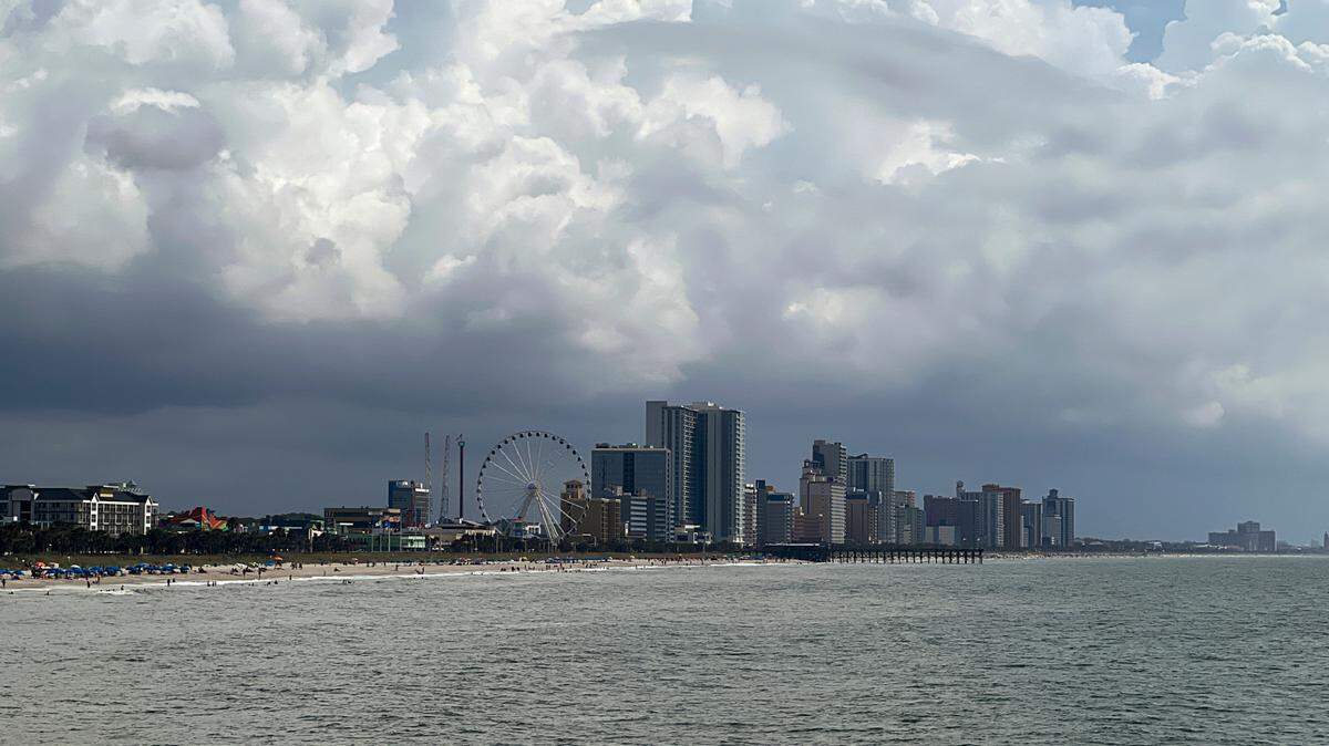
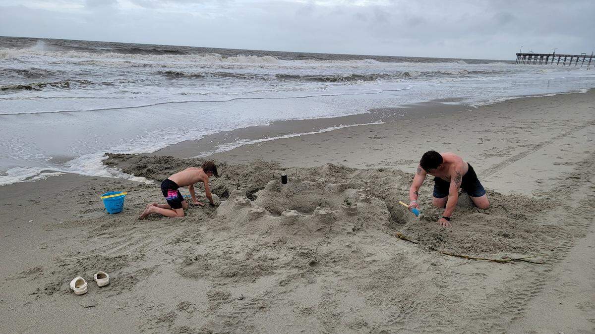
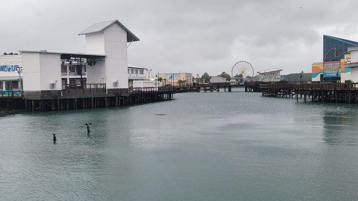
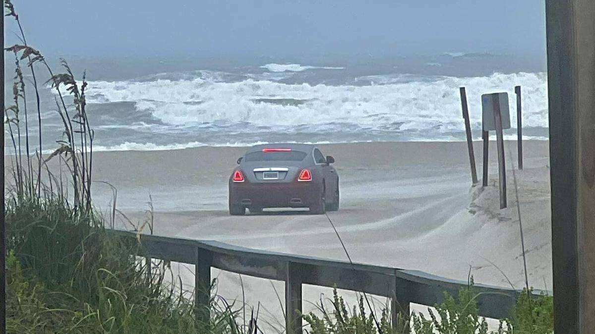
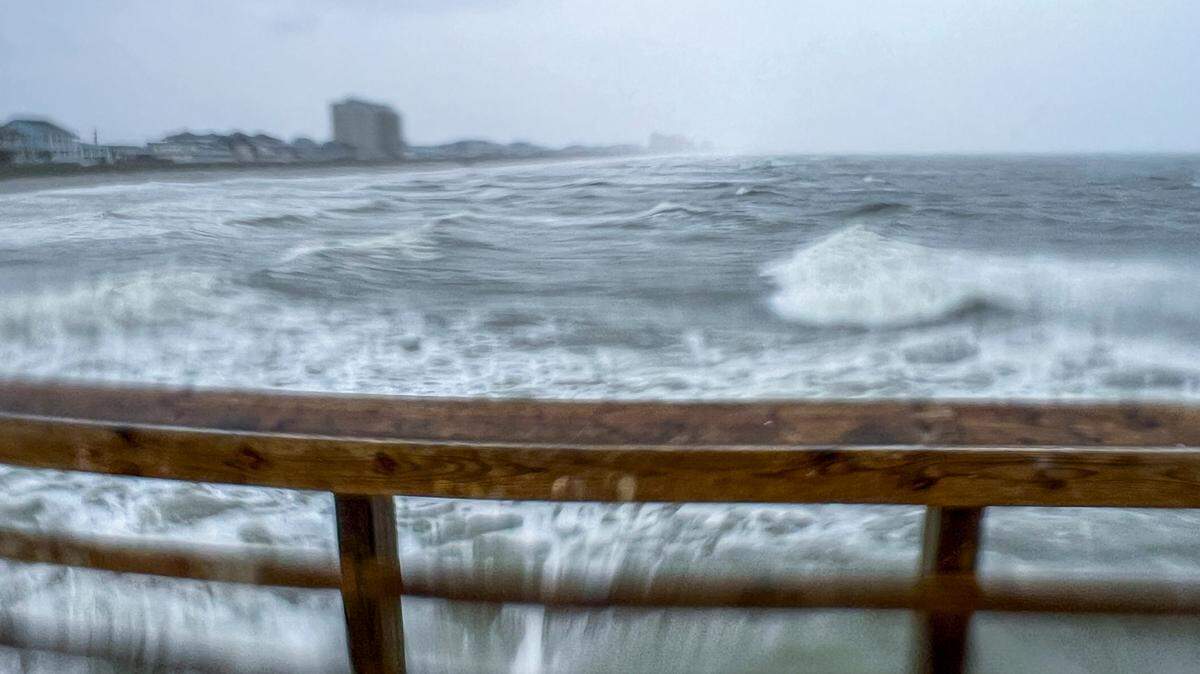
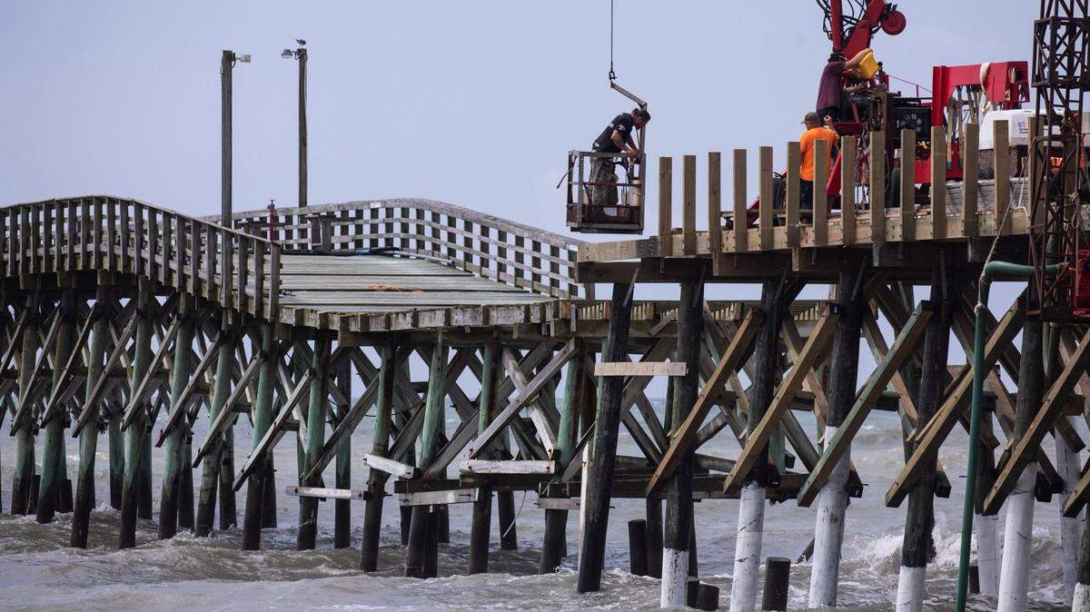
Beach conditions as Tropical Storm Debby continues
UPDATE 7:49 A.M.
Similar to Wednesday, Thursday’s ocean temperature in Myrtle Beach remains around 81 degrees, according to surf conditions from Swell Info.
They also predict waves to remain between one to three feet throughout the day.
The morning low tide was at 4:42 a.m. and the morning’s high tide is predicted to swell at 10:58 a.m. This evening the low tide will take place at 4:52 p.m., with the evening high tide at 10:55 p.m., according to tide maps for Myrtle Beach.
Local and visiting beachgoers have continued to hangout sea side throughout the duration of the storm. Double red flag warnings remain in effect, meaning that no one is allowed to swim in the ocean due to the choppy currents.
- Elizabeth Brewer, ebrewer@thesunnews.com
Horry County road closures
UPDATE 7:07 A.M.
Here are some of the roads in Horry County that are closed so far this morning due to flooding based on maps from the South Carolina Department of Transportation and the county.
- Boundary Street near the Myrtle Beach International Airport
- East Highway 19, Cane Branch Road in Loris
- West Homewood Road in Conway
- S-106 (Long Avenue Exit) outside of Conway
- S-545 (Highway 545) from S-139 to S-66
- US-701 from Chicora Boulevard to Mill Pond Road in Conway
- North Main Street from Mill Pond Road to Chicora Boulevard in Conway
- Elizabeth Brewer, ebrewer@thesunnews.com
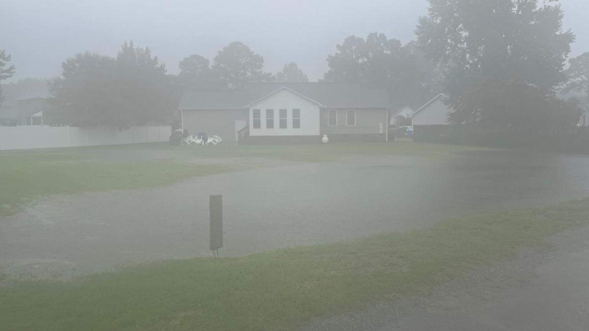
How much rain have we gotten so far?
UPDATE 6:54 A.M.
As of last night, Meteorologist-in-Charge for the National Weather Service out of Wilmington, NC, Steven Pfaff released the rain totals for the Myrtle Beach surrounding communities from Monday night through Wednesday night.
So far the place with the most amount of rain is Loris, with 9.35 inches within a 48 hour time period.
Central Horry County has seen about 6.33 inches and North Myrtle Beach has seen 7.65 inches, according to Pfaff’s report.
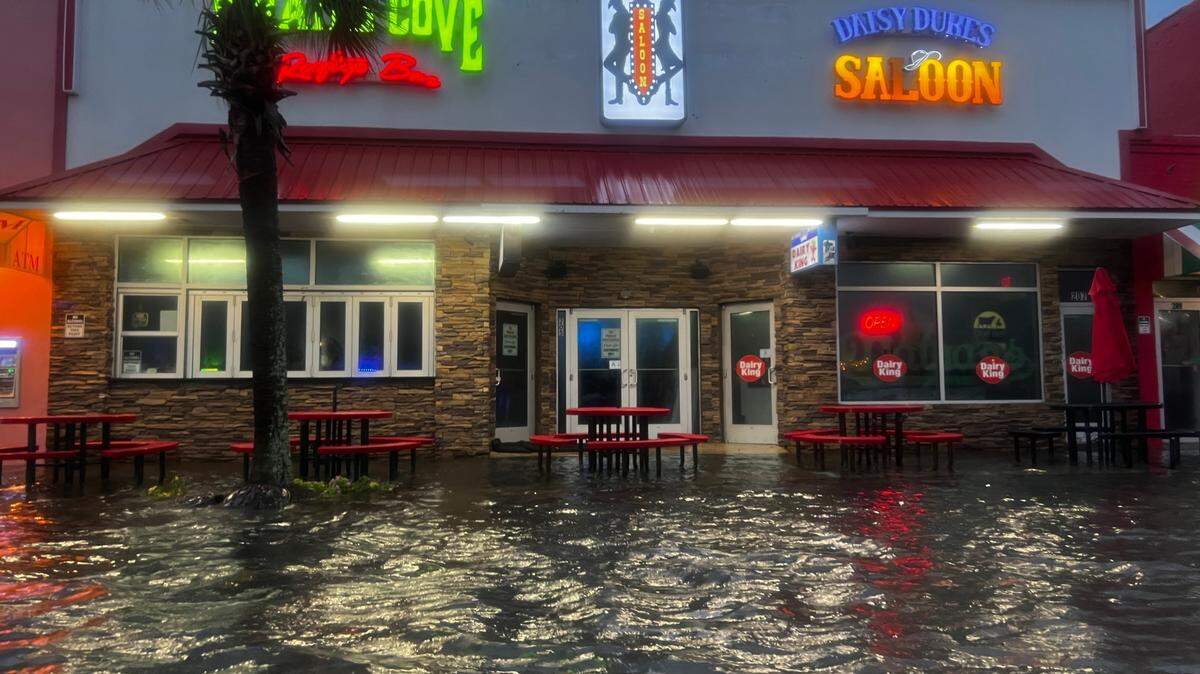
The City of North Myrtle Beach sent out an email on Wednesday night stating that, because of the rain, they will continue to be under a Flood Watch until Friday.
“Our Public Works Department has been on top of monitoring stormwater overflows and drainage ponds,” the email said. “We expect to see flooding more persistent along Ocean Boulevard in the areas of 11th-18th Avenues North and 11th-14th Avenues South as the night carries on.”
The city asks that people do not move or remove manholes or clean out covers because doing so during a storm could cause the sewer system to flood.
- Elizabeth Brewer, ebrewer@thesunnews.com
Today’s expected rainfall
UPDATE 6:36 A.M.
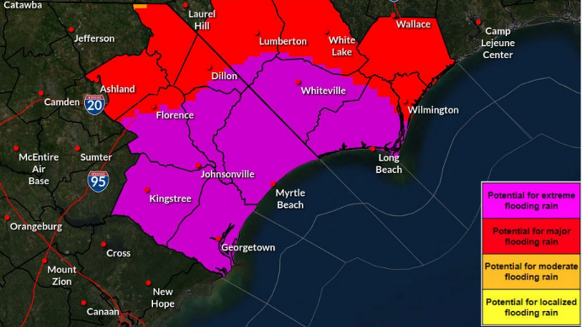
Areas of the Carolinas are still subject to spouts of heavy rainfall and potential floods on Thursday, according to a 5 a.m. forecast from the National Weather Service station in Wilmington, NC.
Additional coastal flooding due to a storm surge is likely along some portions of the North Carolina and South Carolina coastlines through the end of the day today.
Around one to three inches of rain is expected in the region Thursday, bringing some totals in Eastern South Carolina to over 20 inches, the forecast said.
- Elizabeth Brewer, ebrewer@thesunnews.com
This story was originally published August 8, 2024 at 6:53 AM.

.jpeg)
.jpeg)

.jpeg)
.jpeg)
.jpg)


.JPG)