Debby to make landfall in SC Thursday morning, flash flood warning in effect
READ MORE
Tropical Storm Debby
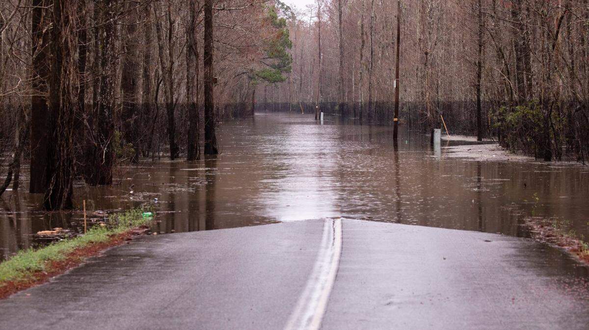
Historic rainfall from Tropical Storm Debby could lead to dangerous flooding. The rain will likely bring dangerous flooding, including flash floods, urban floods and potential storm surges.
Expand All
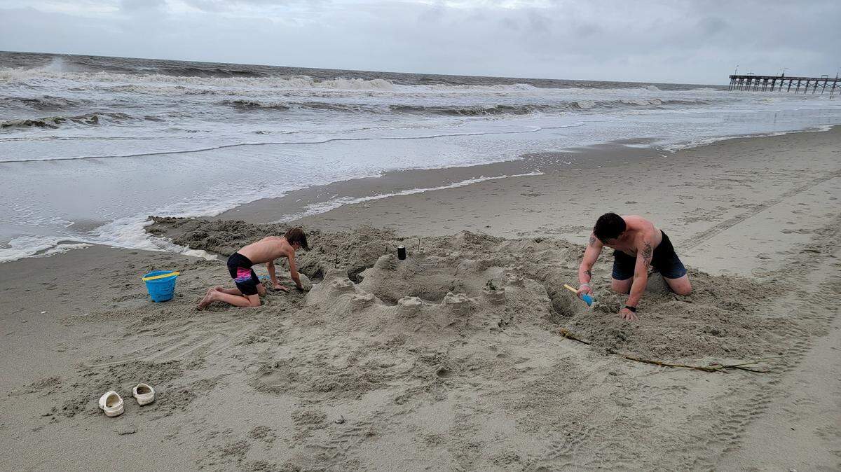
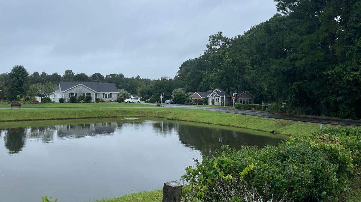
Tropical Storm Debby is expected to continue to affect the Myrtle Beach area through the remainder of this week.
Meteorologists are saying that the Grand Strand could still get historic levels of rain, which could lead to flooding.
A flash flood warning has been issued for parts of Horry County until the evening of Aug. 7. Officials are warning people against driving in flooded areas and not bypassing barricades on the road, as it can be deadly.
The storm warning has extended to include not just coastal cities, but also coastal Pender, New Hanover and Brunswick counties; central Horry County; inland Georgetown County and Williamsburg County, according to National Weather Service’s Meteorologist-in-Charge for the Wilmington, NC station, Steven Pfaff.
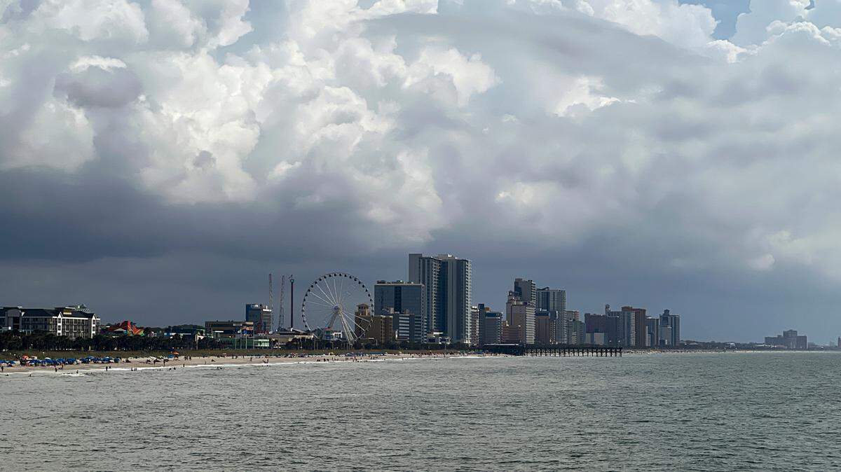
This is the first named tropical system to work its way through Myrtle Beach during the 2024 hurricane season.
Here are the latest updates:
Tropical storm to hit land early Friday morning
UPDATED 8:48 P.M.
Tropical Storm Debby is anticipated to make landfall around 1 a.m. on Aug. 8 north of Charleston, said National Weather Service meteorologist Stephen Keebler. Landfall is not going to change the storm drastically as it’s weakened.
Once it hits land, it will continue to head north. Rain should continue for the next day or so.
Flash flood warning issued for northeastern Horry County
UPDATED 8:21 P.M.
The National Weather Service issued a flood warning that covers the northeastern portion of Horry County, including Little River and Loris. It is set to last until 11:15 p.m. It could impact streets, creeks, highways and low-lying areas.
Loris gets over 9 inches of rain in 24 hours
UPDATED 7:41 P.M.
Loris got 9.35 inches of rain in 48 hours, the most in the Myrtle Beach area, according to the National Weather Service. Conway and North Myrtle Beach followed behind with over 7.5 inches.
Socastee got the least amount with 3.63 inches of rain. Overall, most places got between 3 and 7 inches.
- Emalyn Muzzy emuzzy@thesunnews.com
Debby to make landfall again tonight
UPDATED 6:35 P.M.
Tropical Storm Debby is expected to make landfall again during the night, according to the National Weather Service evening brief. This will bring more rain and tropical storm force winds in the coastal areas. Debby should move out of the area around Thursday night and Friday morning.
Most of the Myrtle Beach area could see winds up to 73 mph, the National Weather Service wrote. The northeastern side of Horry County is expected to have slower winds, with an anticipated maximum speed of 57 mph. These winds plus saturated grounds could cause trees to fall and create power outages.
Southern Horry County is anticipated to get another 2-3 inches of rain, Myrtle Beach and North Myrtle Beach could get 3-4 and northern Horry County near Loris may see another 4-6.
There is a slight risk of tornadoes north of Myrtle Beach through the night.
Most storm conditions should clear by Saturday.
- Emalyn Muzzy emuzzy@thesunnews.com
Horry County landfill and recycling to close on Thursday
UPDATED 5:16 P.M.
The Horry County landfill and recycling convenience will close on Aug. 8. Normal operations are expected to open on Aug. 9.
- Emalyn Muzzy emuzzy@thesunnews.com
Possible tornadoes in Horry County and southern North Carolina
UPDATED 4:05 P.M.
The National Weather Service issued a tornado watch until 11 p.m. for all of Horry County. There’s potential for tornadoes, hail and wind gusts up to 70 mph.
- Emalyn Muzzy emuzzy@thesunnews.com
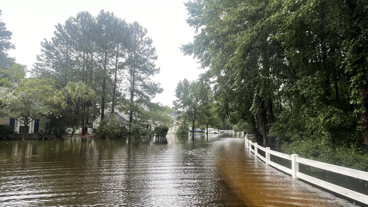
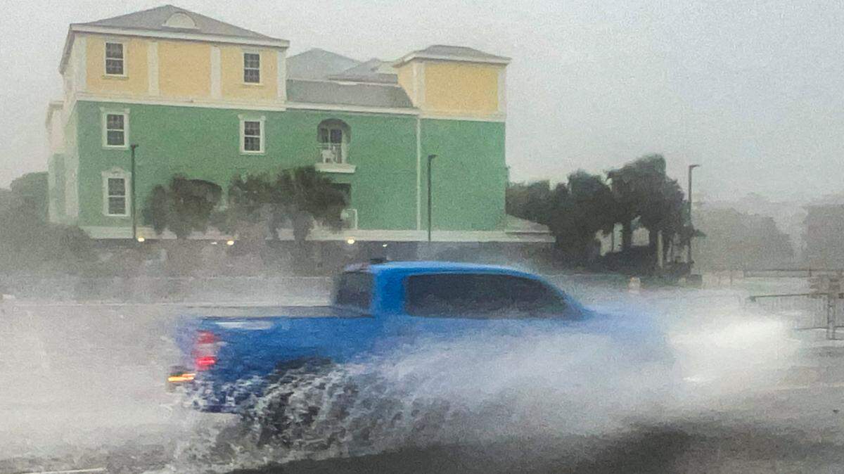
Flash food warning issued for Myrtle Beach, Conway and Little River
UPDATED 2:46 P.M.
A flash flood warning was issued for the area around Conway, Myrtle Beach, Carolina Forest and Little River until 5:45 p.m, according to the National Weather Service.
Experts recommend heading to higher ground immediately. This flash flood warning impacts around 190,000 people.
- Emalyn Muzzy emuzzy@thesunnews.com
Central Horry County has received 7.5 inches of rain
UPDATED 2:46 P.M.
The National Weather Service released rain totals from Monday at 8 a.m. to Wednesday at 8 a.m. The central area of Horry County received the most, with around 7.5 inches of rain.
Cherry Grove has gotten the second highest amount of rain in the North Myrtle Beach area with around 6.24 inches.
Myrtle Beach got between 2 to 4 inches. The area along the northern border of Horry County got the least, with around 1.5 inches.
- Emalyn Muzzy emuzzy@thesunnews.com
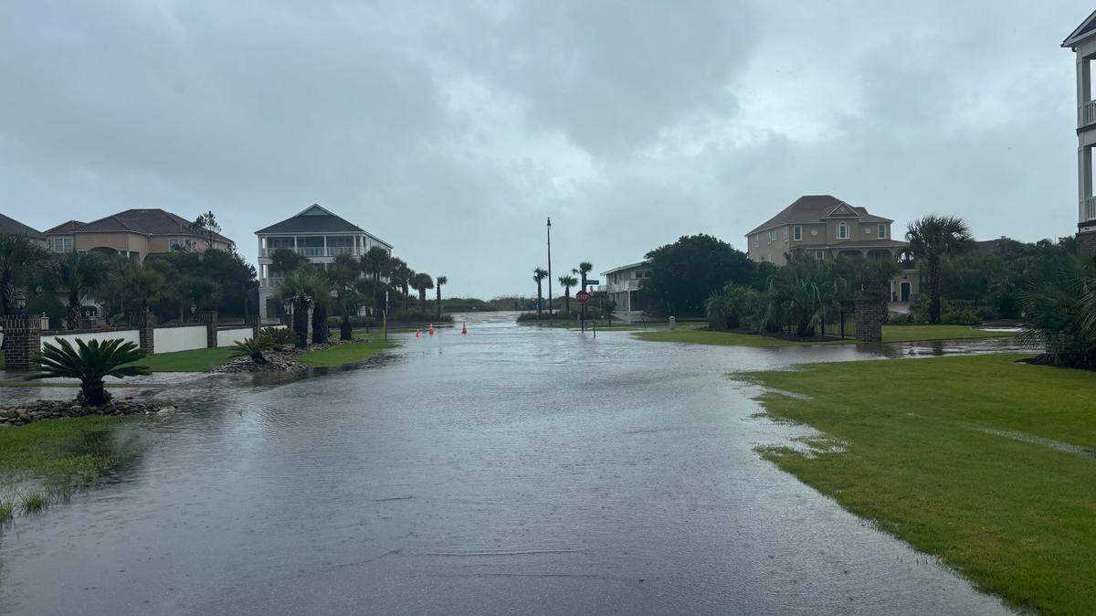
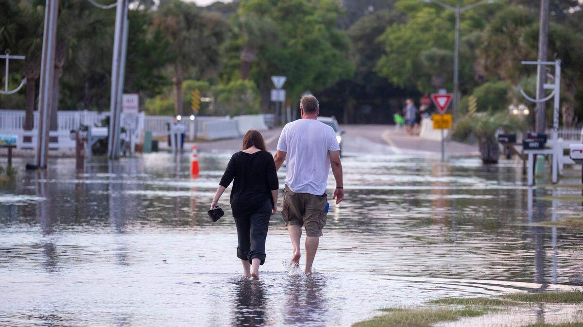
Walmart store parking lot begins to flood
UPDATED 1:53 P.M.
The parking lot at the Kings Road Walmart, 10820 Kings Road in the Myrtle Beach area, is experiencing flooding. There is a retention pond located between U.S. 17 and the parking lot that is overfilling into the parking lot.
The store is closed on Aug. 7 for inclement weather.
- Emalyn Muzzy emuzzy@thesunnews.com

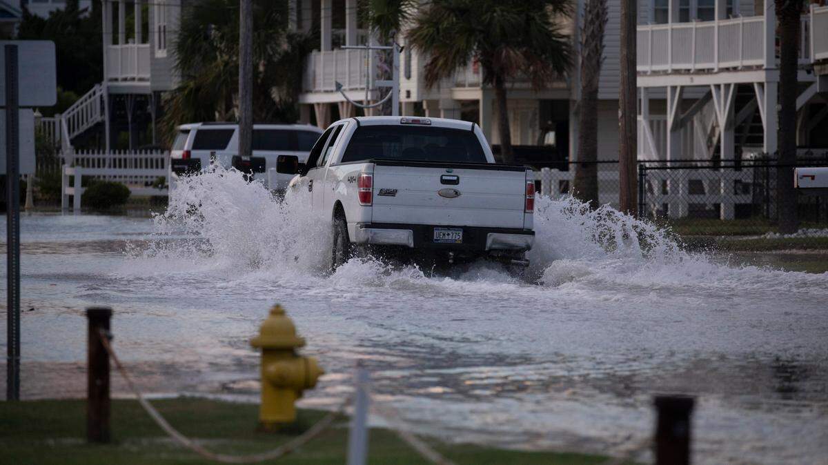
Flood Advisory issued for Horry County
UPDATE 1:30 P.M.
A flood advisory has been issued for Horry County until 4:30 p.m., according to the National Weather Service out of Wilmington, NC.
The flooding will be caused by expected excessive rainfall in the are.
Up to 2.5 inches of rain have fallen already today, with the NWS forecasting at least another inch.
Some locations that could experience some of that minor flooding include: Myrtle Beach, North Myrtle Beach, Surfside Beach, Red Hill,Socastee, Garden City, Murrells Inlet, Little River, Cherry Grove Inlet, Forestbrook, Nixonville, Hand, Bucksville,Barefoot Landing, Wampee and Bucksport.
Power outage near Conway
UPDATE 12:36 P.M.
Approximately 1,200 people are currently without power due to a fallen tree outside of Conway near Bucksport, according to the outage map from Horry Electric Cooperative.
The utility company said it estimates that the power will be restored by 1:30 p.m. Wednesday.
Further north in Cherry Grove Beach, Santee Cooper estimates that six customers lost power earlier today. The cause of that outage remains under investigation, with the utility company stating that it hopes to restore power by 1:45 p.m. Wednesday afternoon.
Data from PowerOutage.us estimates that 1,253 people are currently without power in Horry County, or 0.49% of the customers they track.
- Elizabeth Brewer, ebrewer@thesunnews.com
Storm surge watch canceled
UPDATE 11:37 A.M.
As of 11:18 a.m., the National Weather Service has canceled its storm surge watch for the Myrtle Beach area.
Head meteorologist for NWS in Wilmington, North Carolina, Steven Pfaff said they will announce any minor coastal flooding issues with coastal flood advisories.
The watch was canceled because Pfaff said the expected storm surge lowered to 1 foot to 3 feet from between 2 to 4 feet earlier Wednesday.
Minor flooding could make its way up the coast when high tide comes later this evening, he said via email.
The NWS has also extended a flood warning through 5 p.m. Thursday for the Waccamaw River in Conway and the Little Pee Dee River at Galivants Ferry in Horry County.
- Elizabeth Brewer, ebrewer@thesunnews.com
Sailboat breaks free in Murrells Inlet
UPDATE 10:46 A.M.
A sailboat broke free of its anchor and has begun drifting into the marshy waters of Murrells Inlet in the Myrtle Beach area.
Rain is continuing to fall in some areas and is still forecast to get worse this evening into Thursday.
- Elizabeth Brewer, ebrewer@thesunnews.com
Railroad bridge in Conway closed
UPDATE 10:09 A.M.
The Waccamaw Coast Line Railroad bridge, located at mile 44.4 in Conway has preemptively closed to marine traffic due to anticipated water levels related to Tropical Storm Debby, according to Horry County Public Works.
The National Weather Service out of Wilmington, NC said the Waccamaw River currently stands at 8.68 feet. They forecast that it may rise up to 13.9 feet by Friday.
They said any return to normal bridge operations will be determined later based on weather and water levels.
What are the tractors on the beach for?
UPDATE 9:51 A.M.
Have you seen the tractors on the beach this morning?
According to Horry County Emergency Management Public Information Officer Thomas Bell, it’s common practice before a major weather event like Tropical Storm Debby.
“They do it in advance of any potential impacts,” he said via text message this morning.
The tractors work to push sand up near beach front access points and create sand barriers to help alleviate potential ocean flooding during storm surges.
- Elizabeth Brewer, ebrewer@thesunnews.com
No roads closed in Horry County
UPDATE 8:40 A.M.
According to their road map, Horry County had no road closures as a result of Tropical Storm Debby as of 8:35 a.m.
- Elizabeth Brewer, ebrewer@thesunnews.com
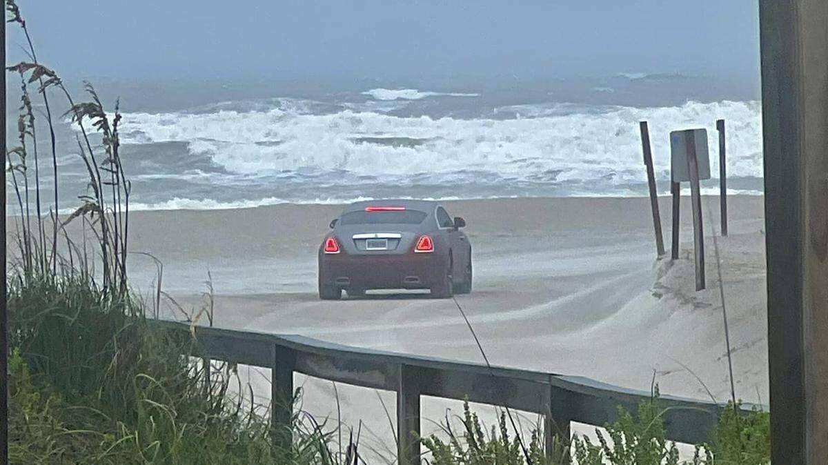
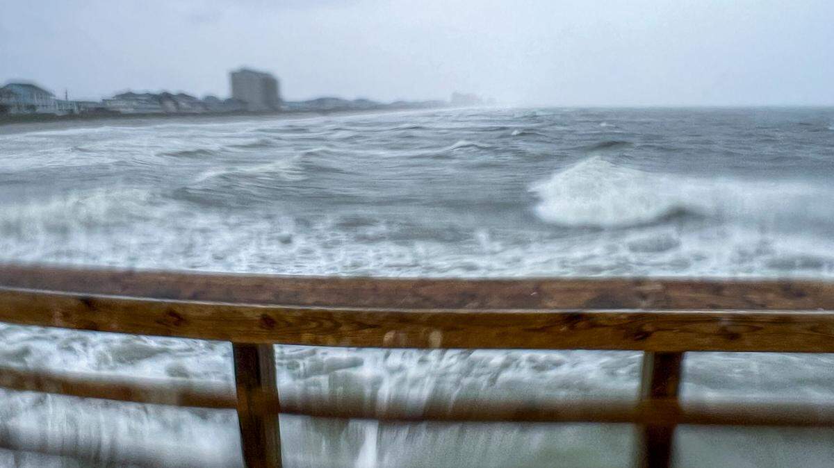
Surf conditions show waves up to five feet
UPDATE 8:14 A.M.
Waves in Myrtle Beach are supposed to reach five and a half feet today with water temperatures hovering around 81 degrees Fahrenheit, according to surf conditions from Swell Info.
The morning low tide was at 4:09 a.m. and the morning’s high tide is predicted to swell at 10:17 a.m. This evening the low tide will take place at 4:14 p.m., with the evening high tide at 10:19 p.m., according to tide maps for Myrtle Beach.
There were double red flag warnings that were in place yesterday afternoon for Myrtle Beach, Surfside and North Myrtle Beach. That means that there was no swimming allowed in the ocean.
- Elizabeth Brewer, ebrewer@thesunnews.com
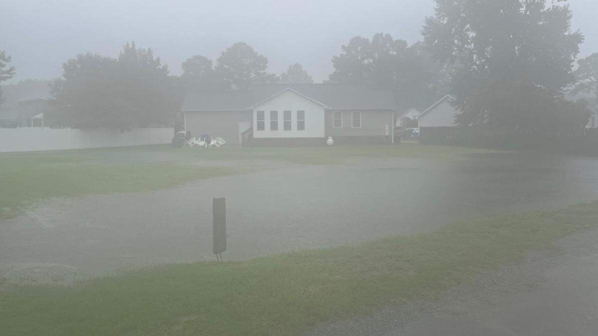
Some storm drains are clogged after yesterday’s rainfall
An example of what forecasts have warned us about: a clogged storm drain that with additional rain could lead to flash floods.

Forecast shows lower rainfalls, flooding still possible
UPDATE 7:52 A.M.
A forecast released by National Weather Service’s Wilmington Meteorologist-in-Charge Steven Pfaff now shows lower total rainfalls, but he said flooding is still possible in the Myrtle Beach area.
Pfaff’s forecast said that the Tropical Storm will slowly move off the coast today before making landfall along South Carolina tonight and picking up forward speed late Thursday and Friday.
This slow progression of the storm will result in heavy rainfall and the potential for what Pfaff is calling “considerable flooding.”
The threat of isolated tornadoes remains today and tonight, before shifting up the coastline into eastern North Carolina on Thursday.
- Elizabeth Brewer, ebrewer@thesunnews.com
Horry County activates emergency operations center
UPDATE 7:47 A.M.
The Horry County Emergency Operations Center is now activated after officials changed their alert status to OPCON 1 (Level 1 Operation Condition) to address any potential storm impacts, according to an email from Horry County Government.
Government offices and facilities will continue operating on a normal schedule today.
Horry Emergency Management said they want to remind all citizens to prepare by:
- Bringing in or securing yard items and decorations.
- Maintaining awareness of weather conditions.
- Avoiding flooded roadways.
- Continually monitoring reputable weather information sources such as local media or the National Hurricane Center for the most up to date hurricane information.
- Elizabeth Brewer, ebrewer@thesunnews.com
Grand Strand closes out patient offices due to the storm
UPDATE 6:30 A.M.
Grand Strand Health announced on Tuesday night via email that they will be closing the following practices and outpatient facilities on Wednesday and Thursday due to Tropical Storm Debby. They will reopen again on Friday, according to their spokeswoman Caroline Preusser.
Grand Strand Medical Center, South Strand Medical Center, North Strand Emergency Room and Carolina Forest Emergency Room will remain open during the storm.
- CareNow Urgent Care Facilities
- Cardiac Rehab Services at Grand Strand Medical Center
- Carolina Forest Imaging Center
- Grand Strand Health Physician Practices
- Grand Strand Bariatric Surgery
- Grand Strand Cosmetic & Reconstructive Care
- Grand Strand Facial & Jaw Surgery
- Grand Strand Heart & Vascular Care
- Grand Strand Infectious Disease
- Grand Strand Orthopedic Care
- Grand Strand Primary Care
- Grand Strand Spine & Neuro Care
- Grand Strand Surgical Care
- Outpatient Lab Services at Grand Strand Health’s Medical Office Building
- South Strand Medical Center’s Outpatient Imaging and Lab Services
- The Advanced Wound Center
- The Breast Center – closing at 1 p.m. on Wednesday
- Elizabeth Brewer, ebrewer@thesunnews.com
Forecast shows rainfall will continue
UPDATE 6:09 A.M.
The worst with Tropical Storm Debby is yet to come.
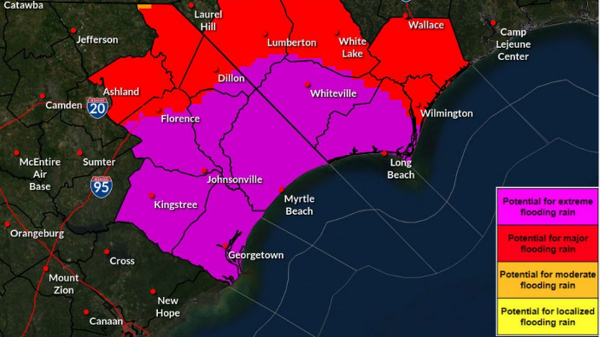
The latest forecast from the National Weather Service in Wilmington, NC, at 5 a.m. on Wednesday shows that historic rainfall is still expected to hit the Myrtle Beach area today into Thursday, which could broaden the area of possible life-threatening flooding.
A few tornados remain possible and will most likely be along the coast if they happen, the report said.
Tropical storm warnings and watches remain in effect for portions of South Carolina through North Carolina through Thursday, according to the NWS.
A tropical storm warning continues to be in effect along coastal Horry County along with a storm surge watch. Central Horry County is also under a tropical storm warning from the NWS as of 5:19 a.m. Wednesday.
A dangerous storm surge is also now possible along the coats of South Carolina and southeastern North Carolina from South Santee River to Cape Fear, the early morning forecast said.
Debby is currently off the coast of Savannah, Georgia and moving slowly to the east, scientists said. As it slowly turn moves closer to the Myrtle Beach area over the next couple days, heavy rain will continue.
The NWS predicted total rainfall of three to nine inches at this point, with higher isolated amounts in some places.
Meteorologists have also now released maps of the storm traveling all the way up the Eastern Atlantic seaboard, with flooding now forecast for the Carolinas and the mid-Atlantic states and into Vermont through Saturday morning.
- Elizabeth Brewer, ebrewer@thesunnews.com
This story was originally published August 7, 2024 at 6:26 AM with the headline "Debby to make landfall in SC Thursday morning, flash flood warning in effect."
.jpeg)
.jpeg)

.jpeg)
.jpeg)
.jpg)


.JPG)