Here’s how this weather event could impact Tropical Storm Debby’s effect in Myrtle Beach

READ MORE
Tropical Storm Debby
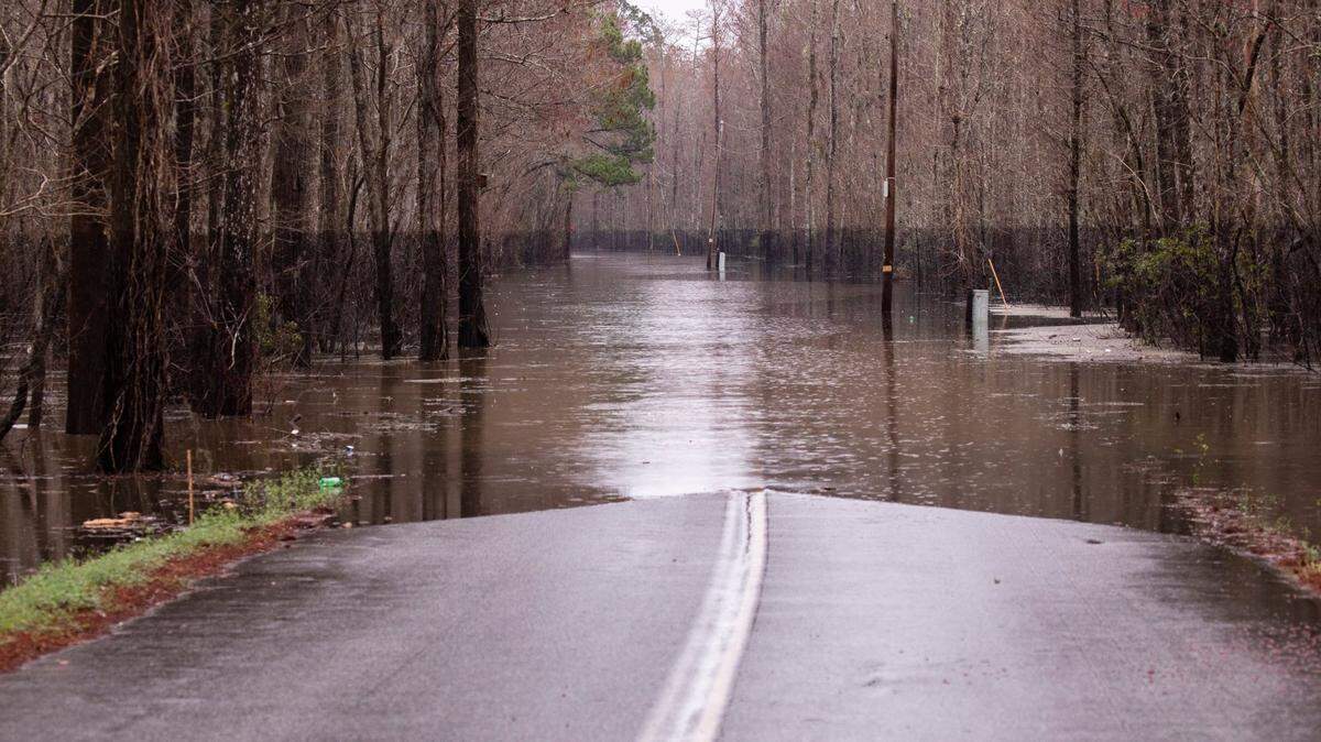
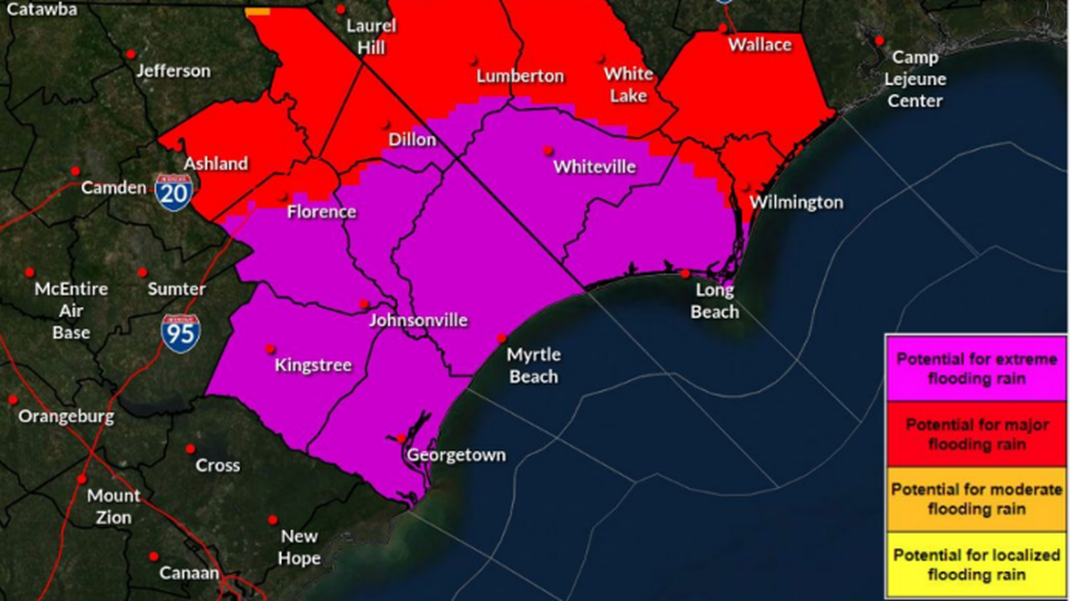
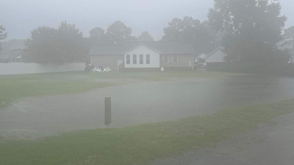
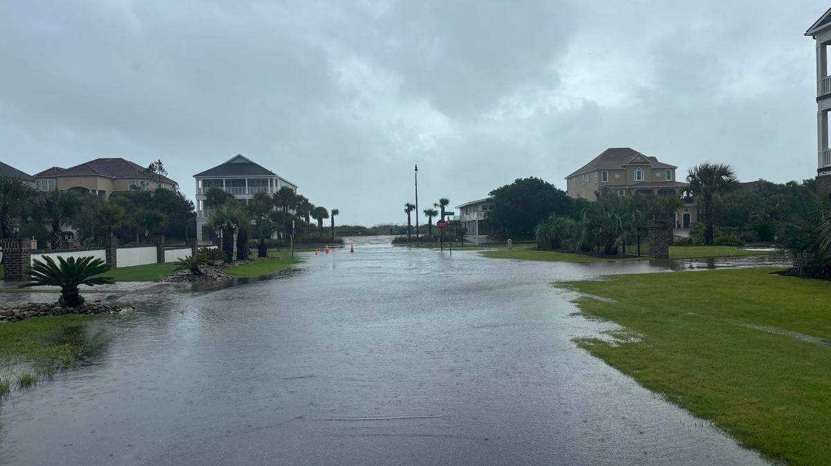
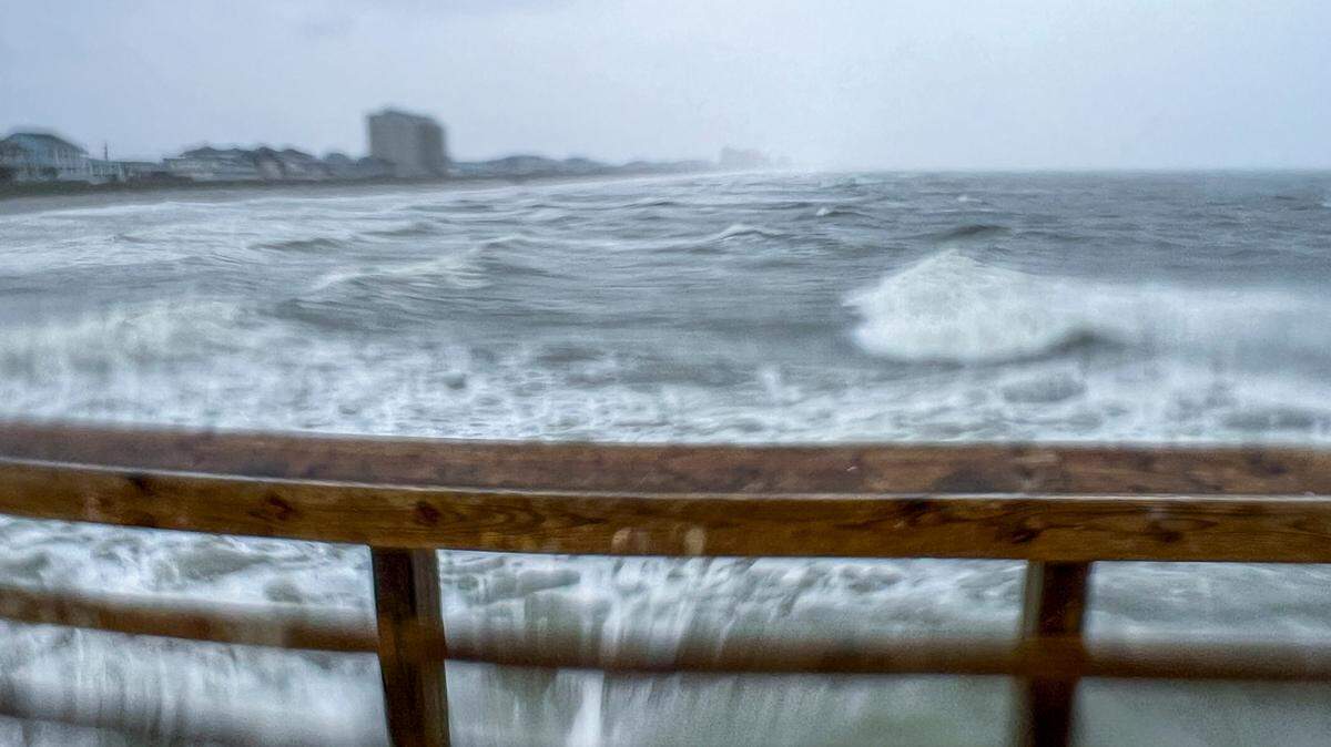
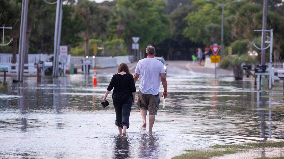
Historic rainfall from Tropical Storm Debby could lead to dangerous flooding. The rain will likely bring dangerous flooding, including flash floods, urban floods and potential storm surges.
Expand All
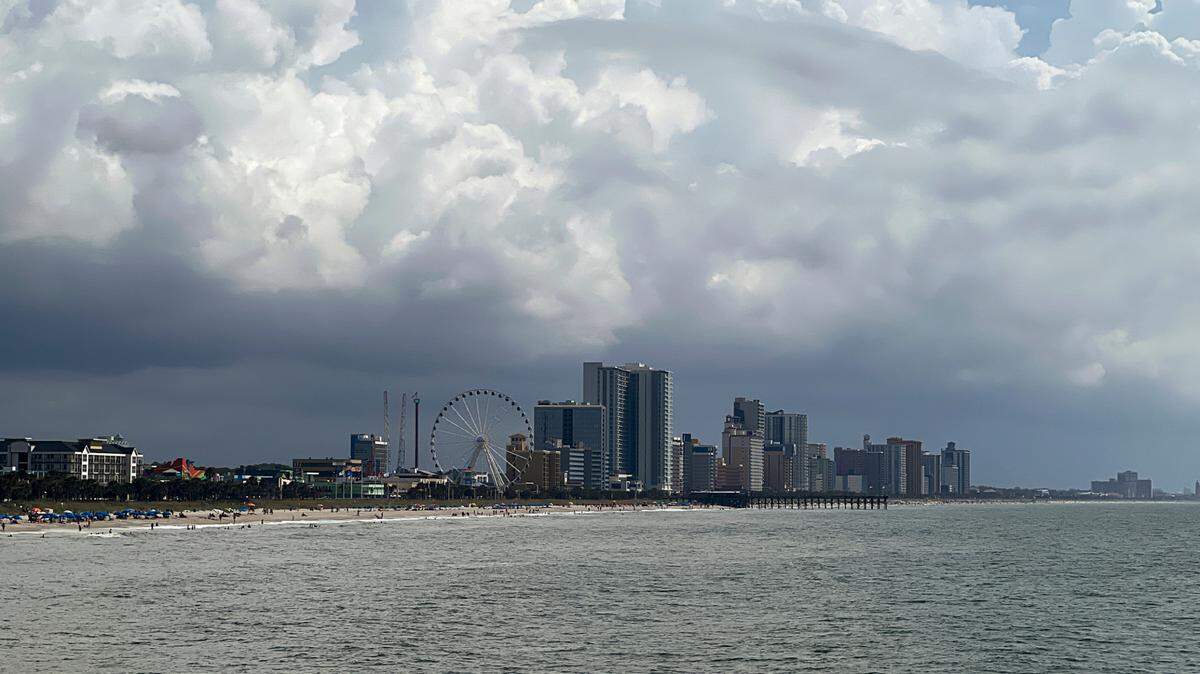
Tropical Storm Debby will move through the Myrtle Beach area sometime Tuesday, Aug. 6, 2024, dropping considerable amounts of rain. However, one weather phenomenon could decide the direction and impact of the storm.
Steven Pfaff is the meteorologist-in-charge at The National Weather Service’s Wilmington Office, and he said that phenomenon is called a “Col.”
Sometimes referred to as a saddle point or neutral point, a Col is a weather region where wind and both high- and low-pressure areas counterbalance each other.
Pfaff said Cols present a challenge for projecting the direction of a storm because the phenomenon lacks a clear direction.

“The challenge is, when you get these Cols that develop, and the storm sits in there, it’s kind of like if you have a scale and you have it equal from the left to the right,” Pfaff added. “Is it going to get to the left side of that scale or get to the right side of that scale when it gets out of that area?”
Pfaff said the impact of Tropical Storm Debby could vary greatly depending on which direction it takes after exiting the Col. If the storm stays offshore, there’s a risk of stronger winds and a storm surge in combination with heavy rainfall.
However, Pfaff said if Tropical Storm Debby moves back into the South Carolina coast south of the Grand Stand and moves westward, the threat of heavier winds and storm surge could be reduced.
“We’re hoping the models get a better feel for what’s going on with that,” He added.
Pfaff also said Tropical Storm Debby should get caught in the Col on either August 7 or 8, 2024. The storm’s arrival is also a bit earlier than usual for storm season.
Typically, the historical peak for tropical cyclones is around Sept. 10, which coincides with when ocean temperatures are typically higher. The National Oceanic and Atmospheric Administration predicted the highest number of storms ever in May 2024, and Atlantic Ocean temperatures are higher than usual at this time of year.
However, Pfaff added that the chance Tropical Storm Debby developed into a hurricane was low and that prior storms had occurred in early August.
“It’s not unprecedented,” he added. “Still, with the potentially hyperactive hurricane season during the peak, are we going to get a one-two punch this year is a big question mark. I hope not.”
This story was originally published August 5, 2024 at 1:51 PM.

.jpeg)

.jpeg)


.jpeg)
.jpeg)
.jpg)


.JPG)