
More heavy rain, potential flash-flooding to hit SC soon. These areas can expect the most rainfall
Had enough of the rain yet?
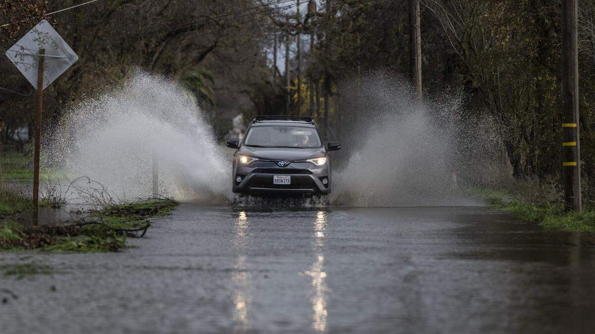
Since the beginning of the week, heavy rain and thunderstorms have dampened outdoor activities throughout South Carolina, and forecasters are predicting even more showers until the end of May.
Here are the latest forecasts:
Rain forecast
According to AccuWeather, a weather forecasting company, the Carolinas will likely see repeated rounds of heavy rain and thunderstorms through the remainder of May, due to a surge of tropical moisture.
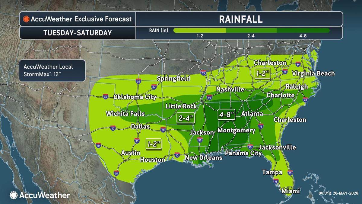
Up until Saturday, much of SC is expected to receive at least an additional 2-4 inches of rain, with some counties in the Upstate, like Pickens, Oconee and Anderson, expected to get hit with 4-8 inches of rain in total. Parts of the Lowcountry and Peedee regions will only experience 1-2 inches of rain.
Repeated rounds of rain over the same locations could quickly overwhelm drainage systems and trigger flash flooding, especially in urban areas.
Because SC is facing an intense drought, the rain will provide relief for agriculture and water supplies.
The National Weather Service predicts the Columbia area will experience hot and humid conditions toward the end of the week, with showers likely to develop in the afternoon. Temperatures are expected to cool down this weekend.
Tropical development
Additionally, there’s a very small chance of tropical development in the coming weeks that could threaten coastal areas in SC, due to the warming waters surrounding Florida and relaxed wind shear.
AccuWeather’s team of tropical meteorologists believes the highest chance for tropical development would occur during the middle to latter part of next week. If a storm were to develop, coastal areas in SC would have a low risk of impact from tropical rain and wind.
“Sea-surface temperatures are running above average in these areas and are generally within a few degrees of 80 degrees, which is near the threshold typically needed for tropical development,” AccuWeather Lead Hurricane Expert Alex DaSilva said.
This comes as the Atlantic hurricane season is about to start on June 1. Forecasters predicted a less-active storm season, thanks to the likely emergence of El Niño.
Current drought conditions
Drought conditions have progressively gotten worse in SC over the past few months, and it is one of the worst the state has experienced since it was first monitored, according to the National Integrated Drought Information System.
Currently, 4.6 million people in SC are living in drought, and the state experienced its third-driest April on record, with only 0.93 inches of rain accumulated during the month. There has never been less total precipitation between January and April in SC in its recorded history. Since the beginning of the year, there has only been 7.03 inches of rain, which is 8.32 inches below normal.
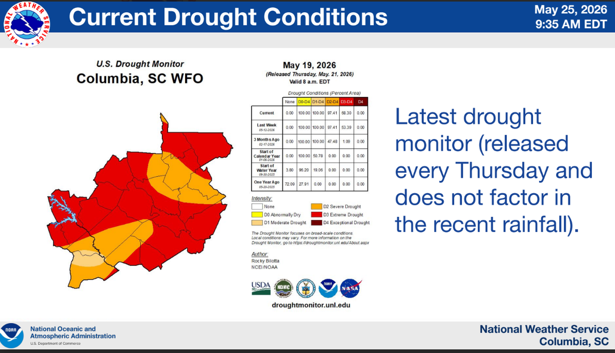
The National Weather Service said that the active week of rain will provide much-needed drought relief, but much of the Columbia area is still in extreme drought, characterized by burn bans, potential water restrictions and low soil moisture.
This story was originally published May 28, 2026 at 5:30 AM with the headline "More heavy rain, potential flash-flooding to hit SC soon. These areas can expect the most rainfall."