Will La Niña bring snow to SC this winter? Here’s the latest forecast

If you were hoping for significant snowfall around South Carolina this winter, you’ll likely be disappointed, a new forecast shows.
The National Weather Service’s Climate Prediction Center issued its updated forecast Thursday for La Niña, stating that a weak La Niña would likely form in the coming months. The arrival of the weather pattern typically means drier and warmer than average winters for the South.
La Niña forecast
According to the latest forecast, there is a 57% chance of a weak La Niña developing through the end of December — a drop from 60% last month. If La Niña forms, it would likely last through January to March.
“The team still favors onset of La Niña, but it is likely to remain weak and have shorter duration than other historical episodes,” the prediction center states. “A weak La Niña would be less likely to result in conventional winter impacts.”
What is La Niña?
La Niña is the opposite of El Niño. Trade winds are even stronger than usual during La Niña events, pushing warm water toward Asia. Off the west coast of the U.S., upwelling increases, bringing cold, nutrient-rich water to the surface. These cold waters in the Pacific push the jet stream northward.
Snow during weak La Niña
NOAA meteorologist Tom Di Liberto recently analyzed snowfall trends during weak La Niña events. Liberto found that in the past nine weak La Niña events, the pattern of snow was similar to to that of all La Niña events, with below-average snowfall in the South.
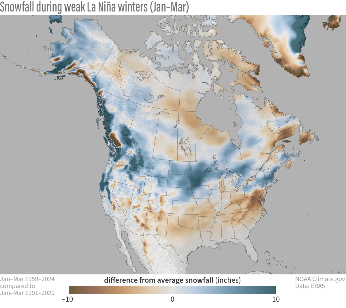
“The count of how many (out of nine) weak La Nina events had below-average snowfall also showed similar patterns, with some bad news for those in Virginia, Maryland, and Washington, D.C., where every single weak La Niña winter had below-average snow,” he wrote.
This story was originally published November 16, 2024 at 6:00 AM with the headline "Will La Niña bring snow to SC this winter? Here’s the latest forecast."