
Murrells Inlet has grown immensely. How much more can the estuary take?
Tom Hora remembers Murrells Inlet when the marsh bottom was filled with life. White and orange sandbars were braided within the mud flats. Shrimping nets pulled starfish, moon fish, crabs and baby flounder. Boats would move in and out with the tide.
“When I was a kid, it was really alive,” Hora, 69, said. “Can’t say it any better than that.”
He remembered cleaning fish on the creek front with his dad, right in front of his grandmother’s house, now torn down to pave the Wahoo’s parking lot. His dad and uncle used to catch stringers of fish, having to lean away from each other to keep the full weight off the ground. Hermitage Creek, the channel in front of his mother’s house a block down the road, was waist deep at low-tide. But these memories are from over half a century ago.
When he moved back permanently in 2001, the Murrells Inlet he once knew had completely changed. The once quaint fishing town grew to become an economic hub that demands all tidal access for commercial boats.
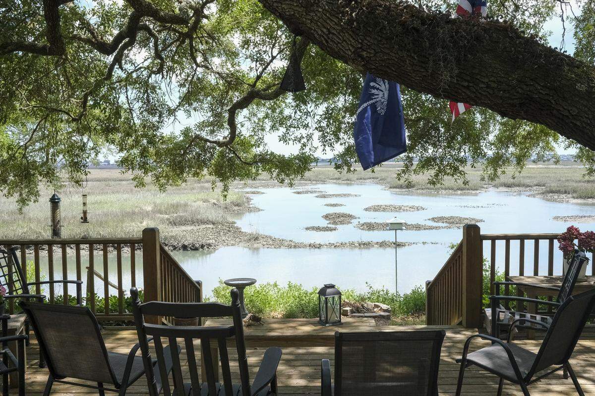
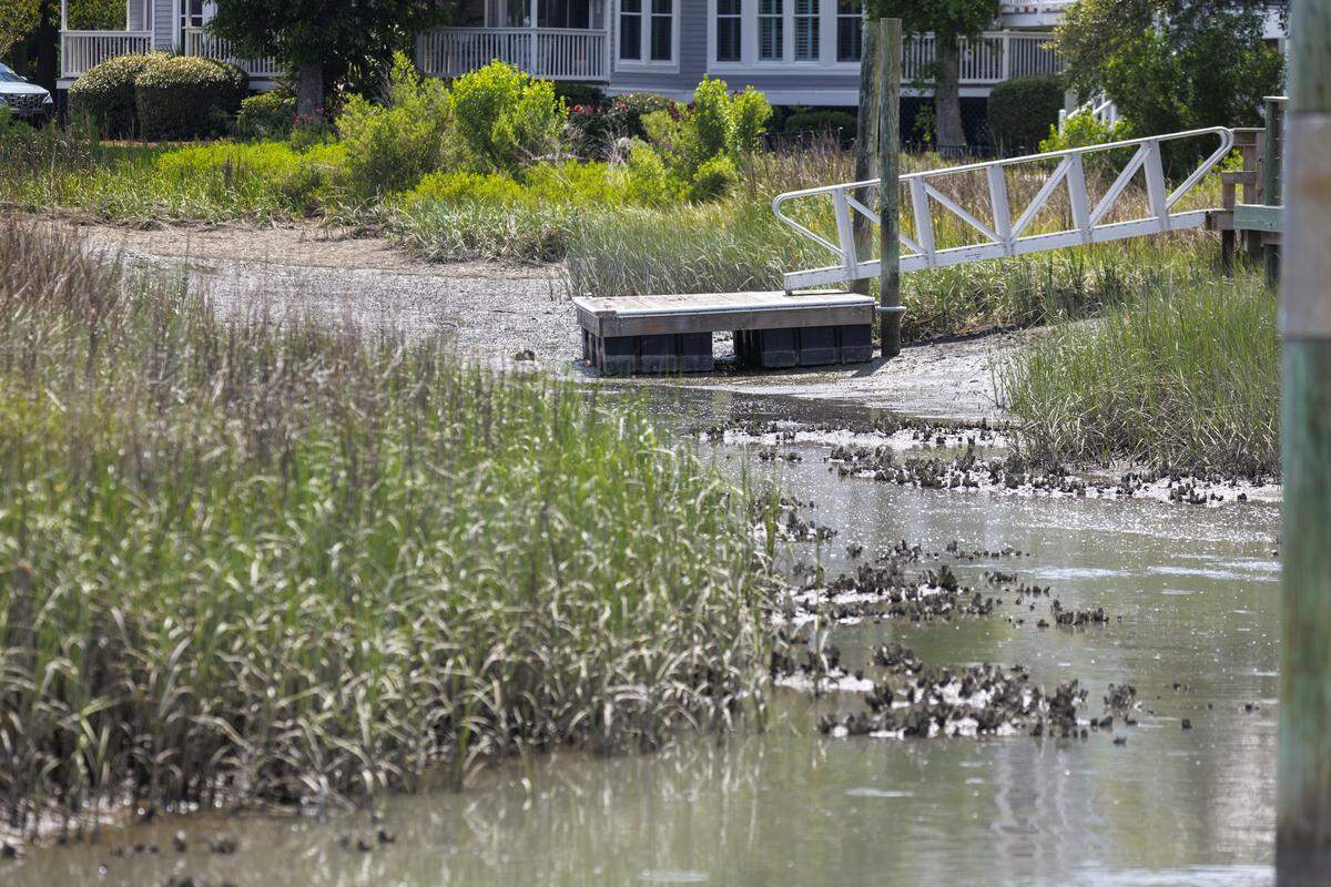
Development has overtaken the land that only lives in his memory, and scientists have said it has stressed the inlet’s health. But it’s impossible to deny that the inlet has naturally silted in, leaving the increasing number of boaters often stranded in once navigable creeks at low-tide.
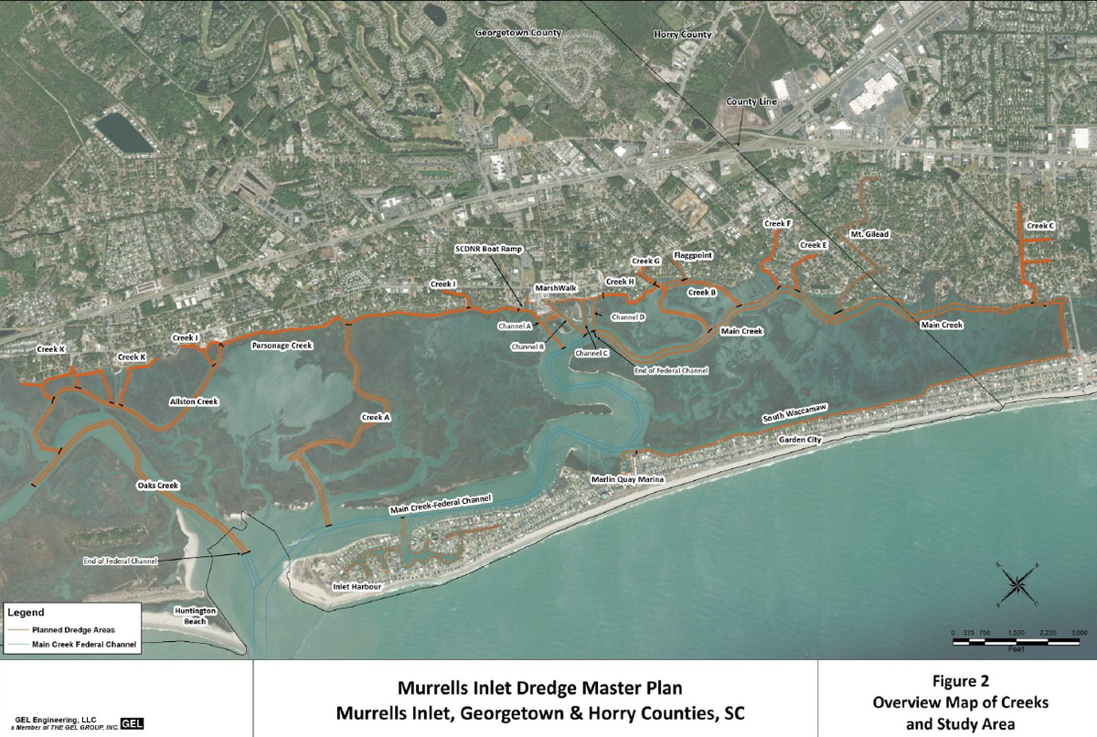
Nearly three years ago, Georgetown County proposed to dredge 16.5 miles of creeks and channels in Murrells Inlet to restore navigable depths at all tidal phases and to dispose 750,000 cubic yards of spoil on a nearshore site parallel to Huntington Beach State Park, but it’s still without permits.
Hora understands the desire for better navigation, but ultimately thinks the proposal is another catalyst to Murrells Inlet’s growth, something he thinks has gone too far, and would increase the amount of large boat traffic and stretch the already thinning resources the inlet provides.
“We as a human race, we want to get all we can out of the little we have,” Hora said.
What’s in Georgetown County’s proposal for dredging?
Georgetown County’s initial project proposal from 2023 included dredging nearly 16.5 miles of natural creeks and man-made channels throughout the inlet. The project, which would be spread across three years, would dredge over 750,000 cubic yards of spoil. The desired nearshore disposal site would be located at least 2,000 feet from the shores of Huntington Beach State Park.
Georgetown County Director of Public Services Carla Harvey said the project is intended to restore the inlet to unobstructed depths during all tidal phases, solely to improve navigation for commercial and recreational boaters.
Kristen Nelson, executive administration assistant, said some of the creeks included in the proposal have not been dredged before, but have silted in from storms and other natural tidal occurrences. Others include man-made channels or widened creeks from previous dredging projects.
Harvey said the project has tremendous community support, especially from landowners who have lost all-time access to the inlet from their homes. During the initial comment period, GEL Engineering, the county’s consulting firm, recorded that 85% of over 100 comments were in support of the project, according to a presentation shared with The Sun News.
Chris Lawhon, general manager of Marlin Quay Marina, overlooks the inlet every day to see a boat stuck in the shallow mud at low tide. More boaters are avoiding the inlet as they pass through the area, he said, resulting in a deficit in fuel, lodging and entertainment revenue for the area.
He said he’s lost roughly 75% of business from larger vessels not wanting to risk damage. As one of the most heavily trafficked inlets on the state’s coast, while he doesn’t want the project to harm the inlet, he said it would be disastrous if it becomes unusable.
State Representative Lee Hewitt agreed, noting the creeks have become difficult to use in the last several years.
“(The inlet) is vitally important,” Hewitt said. “I want to keep it what it is today, which what it is today is not what it was 30 years ago. The quality, the resource, it’s got an awful lot of pressure on it.”
Hewitt led the charge to secure state funding, but he and many other boaters are becoming frustrated with the timeline of securing permits.
He has even taken it to U.S. Senators in hopes to encourage The Corps’ permitting process.
“They certainly are monitoring it,” Hewitt said, adding that the few government shutdowns cut some of The Corps’ funding and delayed the permitting timeline. “Nobody’s pressuring them to do something that they don’t want to do.”
He said the purpose was to get some guidance on where the project stood, and he’s now waiting for the permitting agencies to come back with their recommendations.
Could the project have adverse effects on the estuary’s critical function?
When local environmentalists heard of another push to move the project along, they were concerned not enough people had considered the potential ecological impacts. Chip Smith, founder of the inlet’s annual Spring Tide cleanup event, hosted a community “Creek Talk” with a lineup of scientists last month to discuss the project and the inlet’s health.
Dr. Dennis Allen, former director of the Baruch Marine Field Lab, said at the meeting the project should be significantly scaled, both in terms of size and length of time, from its initial proposal to avoid irreversible effects to the inlet.
“The proposed dredging will reset the way water moves around the creek network, and of course, changes in the chemistry and the biology of the system,” Allen said at the meeting. “Some degree of recovery can be expected. The big question is just how different a system will result once that new state of stability is approached.”
The project initially called for dredging up to nine feet below the Mean Low Water, or average low tide height, in some creeks, and up to seven feet below in others. It noted impacts to 438 acres of essential fish habitat.
Proponents of the project suggested that dredging would allow for better water flow and water quality, but Allen said estuaries are more completely flushed when they are at their shallowest levels. Having deep pockets of stagnant water could create oxygen depletion areas.
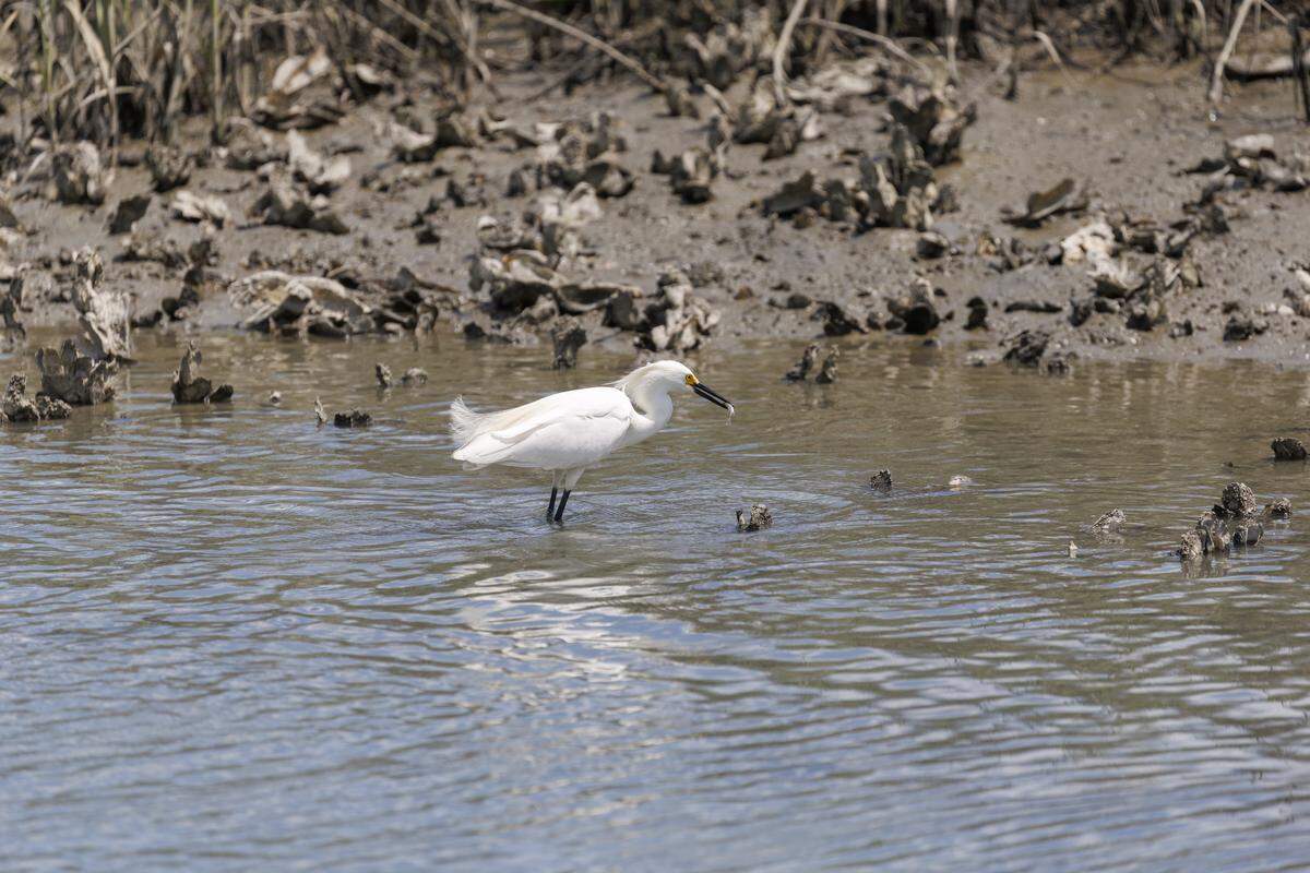
Estuaries are the nurseries of the ocean, Allen said, and the marine life making their start depend on shallow water habitats to thrive. The scale of the dredging could negatively impact the thousands of microorganisms that feed fish and other marine life of the inlet, he said.
“What we have to think about is that reductions in the amount of shallow water habitat that the juvenile stages of those same animals rely on could, in the long run, mean that they’re simply going to be fewer larger fishes produced in the system,” Allen said.
Disposal site near Huntington Beach State Park
But one thing many on both sides of the argument have raised concerns of is the disposal site near Huntington Beach State Park.
Because the spoil would be mostly mud and not beach-grade sand, the ability to cost-effectively use it for beach renourishment is unlikely. Many are worried the amount of sediment placed near the shore won’t stay in place.
Hora and his cousin ride their bikes along Huntington Beach State Park as often as they can. He said he would hate to the see beach covered in mud if the current were to push it ashore, and he hopes the county will decide to dispose the sediment in the least environmentally hazardous manner.
Georgetown County, in response to initial comments from The Corps, has begun another round of modeling and sampling to make sure the desired disposal location is safe. They have also reduced depths to a minimum of four feet for some channels in the dredge plan leading to a decrease in disposal, but in larger channels the goal is eight feet. The county is expecting the studies to take another six to eight months before they can move forward with the permitting agencies.
“This is one of the largest dredging projects (of its kind) to take place in the United States,” Nelson said. “So it’s a very unique project in itself, and (The Corps) wants to make sure that there’s going to be no adverse effects.”
While there will not be a public comment period again if the project moves forward, the county plans to hold a public meeting where residents can ask questions, but that won’t be until the additional studies are completed.
Is the estuary already at a tipping point?
What was once land settled by a couple dozen families, including Hora’s great-grandparents, has transformed to the developed hot spot of Murrells Inlet.
With it came nearly 25% of impervious or developed hard surface, according to a study conducted in 2021.
Dr. Denise Sanger studied the impacts of impervious surfaces on tidal creeks and salt marshes and found once a watershed area connected to those creeks reached above 10-30% hard surface, the tidal creek becomes compromised, she said at the Creek Talk.
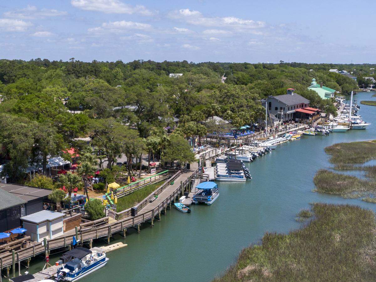
Once belonging to Hora’s great-uncle, Clarke Allen Willcox Jr., the Hermitage’s old site where it stood alone in front of the creek now crowds about a dozen homes in a gated community. His sister-in-law’s house formerly belonging to his mother, who died in 2021, is the only property along Hermitage Creek without a bulk head.
The number of increasing homes, apartments and hotels are sending more and more run-off to the inlet.
When he crosses the Wahoo’s parking lot where his grandmother’s house stood, he sings to himself “They paved paradise, put up a parking lot,” lyrics to the Joni Mitchell song “Big Yellow Taxi.”
“How much can that estuary take?” Hora said.
Hora now lives on family land hugged by trees and spread across two lots. He gets a letter in the mail almost everyday asking if he wants to sell part of his land. And almost every day he’s reminded of the fleeting serenity he fell in love with all those years ago.
The marsh bottom is now nothing more than a bare moonscape, he said. Increased boat traffic and wave action have piled mounds of white oyster shells along the banks, or what he calls a “wall of dead soldiers.”
And while he sympathizes with those who worked hard for their property and want to be able to travel the inlet as they please, he wants it to be healthy and vitalized. The question he asks is what path to take to get there.
“We’re not going to stop it,” Hora said. “It’s a bowling ball, it’s got three holes in it where you can grab a hold of it and hold it sometimes. Do you make a strike? Or do you go in the gutter? It’s hard to say.”